
How an ALTA Survey Supports Commercial Redevelopment Projects
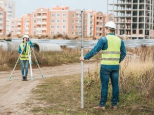 Redevelopment looks simple from the outside. Knock down the old building, put up something better and move on. The ground tells a different story. An existing commercial site carries decades of history in its boundaries, easements and recorded rights, and most of that history stays hidden until a surveyor puts it on paper. An ALTA survey gives you that full picture before you commit money, design work or a construction timeline. Get it early and you make better decisions with fewer surprises.
Understanding Site Conditions Before Redevelopment Begins
Redevelopment starts with land that already has a history of use. There are buildings, parking lots, utility lines and old improvements sitting on the parcel, and each one affects what you can do next. An ALTA survey documents the site as it actually exists today, from structures and pavement to visible utilities and physical encroachments. That record becomes the baseline every other decision rests on.
An ALTA/NSPS land title survey follows a national standard that lenders and title companies recognize. It combines a precise boundary survey with a detailed map of improvements and features on the ground. For a redevelopment project, that means you see the difference between what the records claim and what’s really there.
Here’s what a surveyor typically captures on a developed site:
- Existing buildings, foundations and their setbacks from property lines
- Parking areas, driveways and paved surfaces
- Visible utilities and above-ground infrastructure
- Fences, retaining walls and other improvements near the boundary
- Encroachments from neighboring parcels, or yours onto theirs
Clarifying Boundary Lines and Property Limits
You can’t plan a new footprint until you know exactly where the property ends. Older commercial parcels often carry conflicting deed descriptions, fences built in the wrong spot or lines that everyone assumed but nobody confirmed. A surveyor resolves those conflicts by measuring the parcel against recorded documents and monuments in the field.
Accurate limits change your math. Setback requirements, buildable depth and total developable area all depend on where the true line sits. A boundary that’s off by a few feet can shrink your plan or push a proposed structure into a restricted zone. Confirming the limits early keeps your design grounded in reality instead of guesswork.
Identifying Easements, Access, and Title Issues
Easements decide who else has rights across your land, and they rarely announce themselves. Utility corridors, drainage paths and shared access routes can run straight through the area you planned to build on. An ALTA survey plots these recorded rights on the map and ties them to the specific title exceptions listed in the title commitment.
Access deserves its own attention. A driveway that’s been used for years isn’t the same as a legally recorded right to use it. The survey shows whether records back up your access or you’re relying on assumption, which matters to any lender reviewing the deal. When physical conditions and recorded rights don’t match, the survey brings that conflict to the surface while you still have room to address it.
Title problems often hide in this gap. An old encroachment, an unrecorded easement or a boundary dispute can sit quietly until someone maps the site. Catching these before closing gives you options that disappear once you own the property.
Supporting Site Planning, Design, and Construction Decisions
Once the site data is accurate, your design team can actually use it. Civil engineers and architects rely on the survey to place buildings, set grades and route utilities without colliding with existing constraints. Elevation and topographic detail from Table A options feed directly into grading and drainage design.
The survey also connects to the work that follows. Construction staking translates the approved plan back onto the ground, and that process runs smoother when the base survey is precise. Utility connections, stormwater layout and parking design all improve when they start from verified information rather than estimates. Fewer assumptions up front mean fewer expensive corrections during construction.
Reducing Risk for Developers, Lenders, and Project Teams
Most commercial lenders require an ALTA survey before they’ll fund a redevelopment loan. Title companies use it to issue extended coverage that protects against boundary and survey-related claims. That single document gives everyone at the table, from the developer to the lender to the title underwriter, a shared and reliable view of the property.
Risk drops when surprises show up early. An easement you catch during planning is a design adjustment. The same easement you find after demolition is a budget problem. Ordering the survey at the start of due diligence, rather than the end, gives your team time to solve issues while solutions are still cheap and flexible.
Requirements can vary by property type, lender, title company, municipality, county and project scope. Confirm what your specific project needs early, especially when closing, permitting or construction timing depends on a finished survey.
Frequently Asked Questions
What is an ALTA survey?
It’s a detailed property survey built to standards from the American Land Title Association and the National Society of Professional Surveyors. The map shows boundaries, improvements, easements and other features that lenders and title companies rely on during a commercial transaction.
Do I need an ALTA survey if I already own the property?
Ownership doesn’t remove the risk. Redevelopment changes how you use the land, and a fresh survey confirms current conditions, easements and boundary accuracy before you invest in new design and construction.
How is an ALTA survey different from a standard boundary survey?
A boundary survey focuses mainly on where the property lines fall. An ALTA survey covers that plus improvements, easements, access and optional Table A items, which gives a fuller record for financing and development.
How long does an ALTA survey take?
Timing depends on parcel size, site complexity, records availability and how quickly the title commitment arrives. Simpler sites can wrap up in a couple of weeks, and larger or more complicated parcels take longer, so build it into your schedule early.
When should I order an ALTA survey for a redevelopment project?
Order it as early in the due diligence period as you can. Early results give you time to renegotiate, redesign or walk away before boundary, easement or title issues become costly.
For a free land surveying quote, call us at (678) 552-2824 or send us a message by going here.
Posted in land surveying, land surveyor | Tagged Land Surveying